Best Foot Forward: Three Moors From Ogden Reservoir


Ogden Reservoir is a great starting point for many walks; this route is a longer expedition and certainly one I’d save for a fine day – the views are spectacular. Relatively challenging with several steep climbs, this 11 mile walk ventures across open-access moorland, allowing you to experience the wonder of the Yorkshire Moors first hand.
Beginning from the Ogden Reservoir car park [50p donation], go through the gate next to where an ice cream van is usually parked [GR SE 065 309]. This follows the edge of the woodland surrounding the reservoir, and the track curves and climbs to meet a bridleway. Continue through a metal gate, keep venturing forward until the wind turbines become almost level with you on the left. Here, descend a steep path to cross the river. The path clearly continues across Ovenden Moor. You’ll reach a gate at a distinct track; turn right and you’ll emerge next to an isolated building which was once, I am told, rather a good pub – The Withens!
Advertisement
Hide AdAdvertisement
Hide AdTurn right, walking along the road for a short while. Just before it bends left, there’s a track leading to two farms.
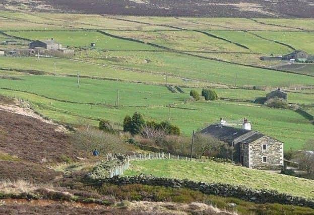
Walk to the furthest farm; of which you skirt the edges [beware of barking dogs!] and orientate yourself in the direction of the distinct anvil-shaped standing stone ahead. This is open access land and the path isn’t always clear, plus it is very boggy underfoot, but continue to orientate yourself in the same direction; as you cross the peak of the moor, there are occasional cairns marking the path.
There’s a gradual descent, with Luddenden Dean emerging ahead. You’ll reach and climb over a stile next to a turreted building. To your left, there’s a way marker indicating the next descent. Follow the way markers as the path becomes more precipitous; you’ll reach another road at the bottom, which you follow to the right, reaching another turreted building with an arched gateway, next to which you’ll see a gate and way marker leading to a steep climb back up the other side of the dean.
Crossing a boundary wall, continue ahead and the land flattens. This again is open access; however, the paths are a little clearer. You’ll join a bridleway briefly but turn left [the path is clear] and then right again, continuing in much the same direction. This brings you on to Wadsworth Moor – using a compass here would help your orientation.
Advertisement
Hide AdAdvertisement
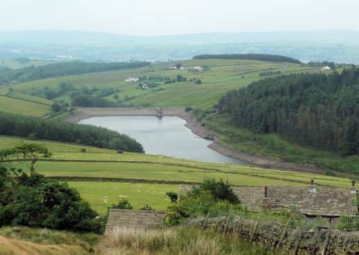
Hide AdYou’ll begin to descend and reach a wall, the edge of the open access moorland. Turn left, following the wall – this is the Calderdale Way; however, you won’t see a way marker for some time – just keep going! You’re walking Keelham Edge and you’ll see the village of Chiserley to your right, beyond which is Hebden Bridge. The Calderdale Way snakes its way around the edge of the moorland, past Hebden Bridge Golf Club and turning back towards Luddenden.
Once you start to pick up the way markers for the Calderdale Way it becomes easier; just be aware that at GR SE 018 276, the path naturally begins to climb up to meet Crow Hill, but the Calderdale Way breaks off to the right – there is a way marker, but you could easily pass it by.
This part of the walk is thankfully quite flat, but sometimes boggy underfoot. You’ll pass above Midgley before curving around to enter Luddenden Dean. Eventually reaching a metal gate, leave the moor; the Calderdale Way follows the road down, bending left, then right – you won’t see many way-markers. At GR SE 033 277, walk down a house’s driveway and through a small gate, with a sign asking for it to be closed behind you. You descend through a field, emerging on to Jerusalem Lane, with a small barn opposite. Turn right, walk past a memorial bench, then turn left at the sign indicating Jerusalem Farm. It’s a slippery descent into the woodland, at the bottom crossing a bridge.
Go straight up the other side of the bank, ignoring the confusing way marker indicating ‘Lower Mytholm’. You’ll ascend, tracing the line of Luddenden Brook trickling beneath you. Reaching a house, continue up ahead, taking the road to climb further until the way marker indicates the path up a track. This steep section winds through farmhouses until the very top, where you can breathe a sigh of relief, and turn to admire the view. The Calderdale Way continues across fields and farmland, again boggy in parts. Climb over the gated stile on the wall, turn right, picking up the way marker on your left to continue past another property, across more farmland. It is less clear here but essentially you need to keep going in the same direction. You’ll reach a brick wall, next to a road, with a large building straight ahead. There’s a gap in the wall through which to hop down. Turn left and walk a short distance to Moor Bottom. Behind the gardens, there is a clear way marker where you can continue along the Calderdale Way. At Hough Gate Head Farm [also a cattery], cross Withens Road and walk approx. 0.25km until the path splits into three.
Advertisement
Hide AdAdvertisement
Hide AdTake the left-hand path, leaving the Calderdale Way – this is the home stretch. Crossing fields diagonally, the path then follows a wall for some time, past Slaughter Gap. Eventually you’ll see the golf course up ahead – cross this safely, climbing out the other side – the path is relatively clear. You’ll meet the bridleway running alongside the Ogden Country Park where you turn right and have a gentle stroll back to the beginning of this wonderful route and perhaps to treat yourself to an ice cream, if the van is still there!